
Soamee worked with inAtlas on their geomarketing and location intelligence platform, a SaaS product that turns over 5 billion geospatial data points into concrete business decisions: where to open a store, which companies to call first, which areas have demand without competition. Today the platform covers over 200 countries through the Dun & Bradstreet network and manages 3.5 million active companies in Spain alone.
The challenge
inAtlas was founded in 2010 as a spinoff from consulting firm Intelligent Coast with a clear goal: let any company answer “where are my customers?” without needing a GIS department. The problem is that answering that question requires crossing data from very different sources — cadastral records, census data, business registries, mobility data, points of interest — and presenting them on a map that a sales director can read without technical training.
The technical challenge had several layers:
- Data volume: over 5 billion geospatial points that need to be indexed, cross-referenced, and served in milliseconds when a user zooms into a specific neighbourhood.
- Granular resolution: analyses go down to building entrance level, not postcode. That multiplies both cartographic and computational complexity.
- Heterogeneous sources: INE (Spain’s national statistics institute), CNIG, cadastral records, business directories, the global Dun & Bradstreet network with 550 million profiles, and customs data from 80 countries. Each source has its own format, update frequency, and gaps.
- Non-technical users: the interface needs to let a retail chain’s expansion manager find hot zones, filter by spending capacity, and export a report — without writing a single query.
Our solution
Geospatial analysis engine
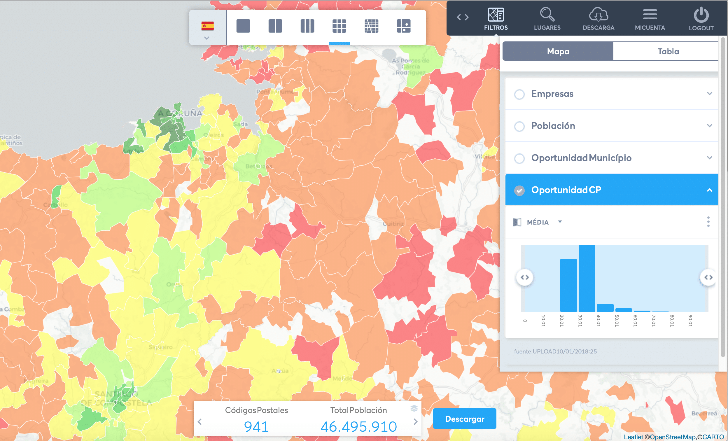
The core of inAtlas is an engine that crosses location with business and sociodemographic data in real time. A user can select an area on the map and instantly see how many companies in sector X bill more than Y, how many households match spending profile Z, and where the nearest competition sits. The engine processes these cross-references across 5 billion points with no perceptible latency.
Heatmaps and location scoring
For store opening decisions, the platform generates heatmaps that score each zone against over 500 indicators: target population density, competitor presence, accessibility, foot traffic, disposable income. The result is a ranked list of candidate locations with a breakdown of each score — not an opaque recommendation.
Business and household segmentation
In the Iberian market, inAtlas provides access to 3.5 million active companies across Spain and Portugal, filterable by activity sector (CNAE code), turnover, headcount, risk level, and payment history. Households are segmented into 86 spending categories — from groceries to insurance — by crossing INE data with proprietary purchasing power models.
Globally, integration with the Dun & Bradstreet network gives access to 550 million business profiles across over 200 countries, with the same type of filters adapted to each market’s data availability.
Customs intelligence
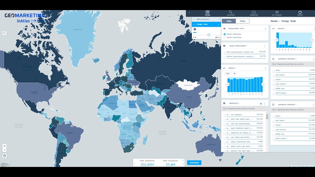
A differentiating module: inAtlas indexes 400 million foreign trade operations from customs authorities in 80 countries. This lets a Spanish manufacturer find out which companies in Mexico already buy a product similar to theirs, with volumes and frequencies. Commercial prospecting stops being cold because you arrive knowing the buyer already has the need.
GeoCRM
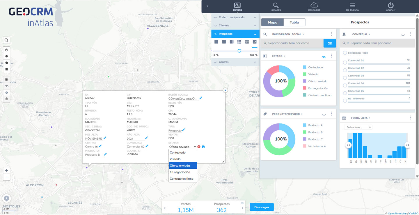
In 2026 inAtlas launched GeoCRM, which adds the geospatial layer to sales management. Instead of a flat contact list, the sales team sees its customers and prospects on the map, enriched with economic and sociodemographic data. Sales territories are assigned on the map and route planning moves off the spreadsheet.
Vertical solutions (GeoBiz)
The platform adapts to nine sectors with specific configurations:
- Retail: identifying zones for new openings and cannibalisation analysis between own stores
- Real estate: asset valuation by crossing cadastral data, area income, and demand
- Banking and insurance: territorial risk analysis and detection of underserved zones
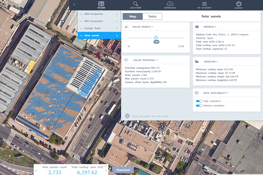
- Energy: infrastructure planning combining consumption data and density — the solar module analyses the photovoltaic potential of each rooftop by crossing cadastral data with irradiation data
- Telecommunications: coverage vs. demand to prioritise network rollout
- Import/export: prospecting with real customs data
Results
- 5B+ geospatial data points processed on the platform, with millisecond response times
- 200+ countries covered through the Dun & Bradstreet network
- 3.5M companies indexed in the Iberian market alone
- 550M business profiles accessible worldwide
- 400M customs operations from 80 countries for trade intelligence
- 86 spending categories per household for consumer segmentation
- Informa D&B acquired 50% of inAtlas in January 2022, validating the platform as the geomarketing benchmark in Spain and Portugal
- A restaurant chain used inAtlas to open 12 locations in one year with revenues 30% higher than their previous openings’ average
Tech stack
- 100% cloud SaaS platform
- Proprietary GIS engine (no external dependencies)
- Artificial intelligence for predictive models and data enrichment
- Interactive cartography with building-level resolution
- Integration with official sources (INE, CNIG, Cadastre)
- Global Dun & Bradstreet network
- Customs data from 80 countries
Need to turn location data into business decisions? See our SaaS platform development service →
How we work
Every project follows our artisan process, adapted to each client's specific needs.
Discovery & Requirements
Deep dive into business, users and objectives. Ideation workshops, market research and MVP scope definition.
Design & Architecture
Wireframes, interactive prototypes and technical architecture. Client validation before writing code.
Development & Testing
2-week sprints with demos. CI/CD, code review and continuous testing. Feedback every iteration.
Delivery & Evolution
Production deploy, monitoring and support. Post-launch metrics and continuous improvement roadmap.